|
|
|
0 members (),
512
guests, and
34
robots. |
|
Key:
Admin,
Global Mod,
Mod
|
|
S |
M |
T |
W |
T |
F |
S |
|
|
|
|
1
|
2
|
3
|
4
|
|
5
|
6
|
7
|
8
|
9
|
10
|
11
|
|
12
|
13
|
14
|
15
|
16
|
17
|
18
|
|
19
|
20
|
21
|
22
|
23
|
24
|
25
|
|
26
|
27
|
28
|
29
|
30
|
31
|
|
|
There are no members with birthdays on this day. |

#664757
Tue 04 Aug 2020 12:37:PM
|
Joined: Feb 2001
Posts: 381,903
Launch Director
|
OP

Launch Director
Joined: Feb 2001
Posts: 381,903 |
Isaias Damage Assessment Imagery Available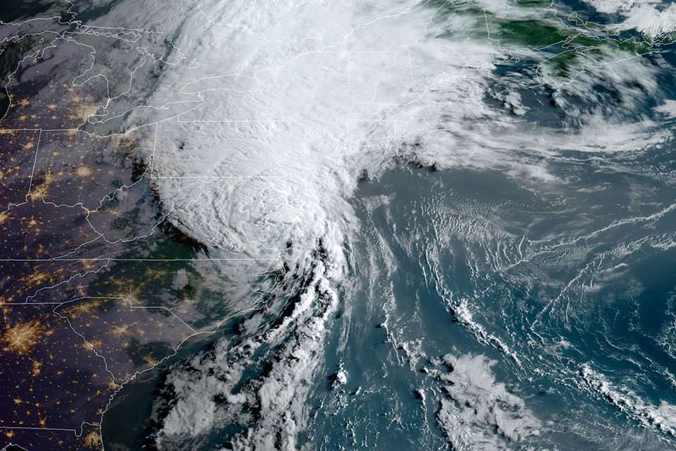
On August 3, 2020, the National Geodetic Survey (NGS) began collecting aerial damage assessment images of areas affected by Tropical Storm Isaias. Imagery is being collected in specific areas identified by NOAA in coordination with the U.S. Coast Guard. Collected images are available to view online via the NGS aerial imagery viewer. Continue reading → https://oceanservice.noaa.gov/news/aug20/ngs-storm-imagery-isaias.html
|
|


CMS The Best Conveyancing solicitors conveyancing quotes throughout the UK
For any webhosting enquiries please email webmaster@aus-city.com
|
|
Forums60
Topics687,450
Posts722,061
Members2,957
| |
Most Online3,142
Jan 16th, 2023
|
|
|
|
|
Copyright 1996 - 2023 by David Cottle. Designed by David Bate Jr. All Rights Reserved.
By using this forum, the user agrees not to transfer any data or technical information received under the agreement, to any other entity without the express approval of the AUS-CITY Forum Admins and/or authors of individual posts (Forum Admins and DoD/USSPACECOM for the analysis of satellite tracking data).
Two-line elements (TLE) and all other satellite data presented and distributed via this forum and e-mail lists of AUS-CITY are distributed with permission from DoD/USSTRATCOM.

Reprise Hosting

|

|


 - Click image for larger picture.")


