|
0 members (),
170
guests, and
30
robots. |
|
Key:
Admin,
Global Mod,
Mod
|
|
S |
M |
T |
W |
T |
F |
S |
|
|
|
|
|
|
|
1
|
|
2
|
3
|
4
|
5
|
6
|
7
|
8
|
|
9
|
10
|
11
|
12
|
13
|
14
|
15
|
|
16
|
17
|
18
|
19
|
20
|
21
|
22
|
|
23
|
24
|
25
|
26
|
27
|
28
|
29
|
|
30
|
|
|
|
|
|
|
|
There are no members with birthdays on this day. |

#722432
Sat 11 May 2024 07:21:PM
|
Joined: Feb 2001
Posts: 381,903
Launch Director
|
OP

Launch Director
Joined: Feb 2001
Posts: 381,903 |
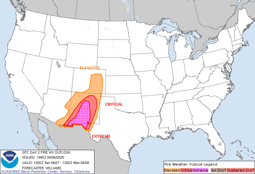
SPC Day 2 Fire Weather OutlookSPC Day 2 Fire Weather Outlook 
Day 2 Fire Weather Outlook
NWS Storm Prediction Center Norman OK
0219 PM CDT Sat May 11 2024

Valid 121200Z - 131200Z

...CRITICAL FIRE WEATHER AREA FOR PORTIONS OF SOUTHERN NEW MEXICO
AND FAR WEST TEXAS...

...20z Update...
Minimal changes have been made to the critical area on the north and
east fringes for the latest guidance. Widespread elevated, and a few
hours of critical, fire-weather conditions appear likely Sunday.
Please see the prior discussion for more details.

..Lyons.. 05/11/2024

.PREV DISCUSSION... /ISSUED 0205 AM CDT Sat May 11 2024/

...Synopsis...
A mid-level trough will traverse the southern Plains tomorrow
(Sunday), encouraging surface lee troughing across the southern High
Plains as a low-level mass response. Across portions of southern New
Mexico into Far West Texas, surface winds may exceed 20 mph at times
(with higher gusts) while RH drops to 10 percent for at least a few
hours Sunday afternoon. Critical highlights have been introduced
where there is strong agreement among guidance members in these
conditions occurring.

Elsewhere across the CONUS, dry conditions may persist across the
Florida Peninsula, but the lack of an appreciable surface wind field
precludes fire weather highlights. Likewise, fire weather highlights
have been withheld over portions of the northern Plains. Here
widespread northerly surface winds exceeding 15 mph will be common,
but with marginally supportive RH and fuels tempering the
wildfire-spread threat to anything more than a localized threat.

...Please see www.spc.noaa.gov/fire for graphic product...
Read morehttps://www.spc.noaa.gov/products/fire_wx/fwdy2.html
|
|


CMS The Best Conveyancing solicitors conveyancing quotes throughout the UK
For any webhosting enquiries please email webmaster@aus-city.com
|
|
Forums60
Topics688,582
Posts723,196
Members2,957
| |
Most Online3,142
Jan 16th, 2023
|
|
|