|
|
|
0 members (),
617
guests, and
27
robots. |
|
Key:
Admin,
Global Mod,
Mod
|
|
S |
M |
T |
W |
T |
F |
S |
|
|
1
|
2
|
3
|
4
|
5
|
6
|
|
7
|
8
|
9
|
10
|
11
|
12
|
13
|
|
14
|
15
|
16
|
17
|
18
|
19
|
20
|
|
21
|
22
|
23
|
24
|
25
|
26
|
27
|
|
28
|
29
|
30
|
|
|
|
|
|
There are no members with birthdays on this day. |

#664969
Mon 23 Jun 2014 12:00:PM
|
Joined: Feb 2001
Posts: 381,903
Launch Director
|
OP

Launch Director
Joined: Feb 2001
Posts: 381,903 |
NOAA Helps ‘Rescue’ Century-old Data from the Grand Canyon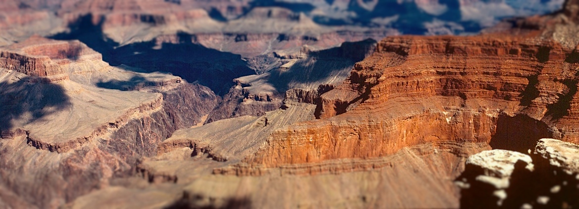 Surveyors from NOAA and the U.S. Geological Survey recently teamed up to update hundreds of geodetic control points in and around the Grandy Canyon. If you want to determine where you are (in the Grand Canyon or anywhere in the U.S.), you need a known starting, or reference, point. Take a bunch of these points, and you have a spatial reference system. In the U.S., the National Spatial Reference System ensures that all U.S. positioning information, including every map made by any government agency, fits together. Surveyors and others depend on the NSRS to ensure that positional coordinates are correct when creating or improving maps, setting property boundaries, planning and designing roads and bridges, and simply trying to predict if your backyard will flood the next time it rains. Continue reading → https://oceanservice.noaa.gov/news/june14/grand-canyon.html
|
|


CMS The Best Conveyancing solicitors conveyancing quotes throughout the UK
For any webhosting enquiries please email webmaster@aus-city.com
|
|
Forums60
Topics684,551
Posts719,161
Members2,957
| |
Most Online3,142
Jan 16th, 2023
|
|
|
|
|
Copyright 1996 - 2023 by David Cottle. Designed by David Bate Jr. All Rights Reserved.
By using this forum, the user agrees not to transfer any data or technical information received under the agreement, to any other entity without the express approval of the AUS-CITY Forum Admins and/or authors of individual posts (Forum Admins and DoD/USSPACECOM for the analysis of satellite tracking data).
Two-line elements (TLE) and all other satellite data presented and distributed via this forum and e-mail lists of AUS-CITY are distributed with permission from DoD/USSTRATCOM.

Reprise Hosting

|

|


 - Click image for larger picture.")


