|
0 members (),
556
guests, and
27
robots. |
|
Key:
Admin,
Global Mod,
Mod
|
|
S |
M |
T |
W |
T |
F |
S |
|
|
|
|
1
|
2
|
3
|
4
|
|
5
|
6
|
7
|
8
|
9
|
10
|
11
|
|
12
|
13
|
14
|
15
|
16
|
17
|
18
|
|
19
|
20
|
21
|
22
|
23
|
24
|
25
|
|
26
|
27
|
28
|
29
|
30
|
31
|
|
|
There are no members with birthdays on this day. |

#665307
Sun 03 Jul 2022 06:46:PM
|
Joined: Feb 2001
Posts: 381,903
Launch Director
|
OP

Launch Director
Joined: Feb 2001
Posts: 381,903 |
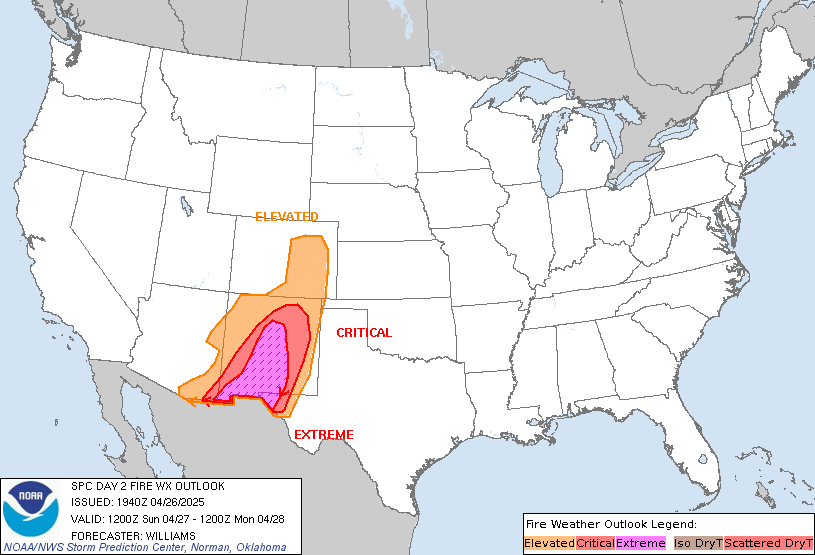
SPC Day 2 Fire Weather OutlookSPC Day 2 Fire Weather Outlook 
Day 2 Fire Weather Outlook
NWS Storm Prediction Center Norman OK
0145 PM CDT Sun Jul 03 2022

Valid 041200Z - 051200Z

...CRITICAL FIRE WEATHER AREA FOR PORTIONS OF THE EASTERN GREAT
BASIN...

The primary change with this update was to expand the Elevated
highlights northeastward into parts of WY. Here, a multi-model
consensus depicts a swath of sustained southwesterly surface winds
near 20 mph with gusts up to 30 mph amid single digit to lower teens
RH. Given the presence of modestly receptive (albeit not quite
critical) fuels where these conditions are expected, the Elevated
highlights are warranted. Elsewhere, the previous forecast (see
below) remains on track.

..Weinman.. 07/03/2022

.PREV DISCUSSION... /ISSUED 0145 AM CDT Sun Jul 03 2022/

...Synopsis...
The mid-level trough positioned across the Interior West on Day
1/today will translate northward toward the Canadian border
tomorrow/Monday as upper ridging strengthens across the central U.S.
While upper support across the West will subside through the day,
surface lee troughing is still expected to take shape across the
eastern Great Basin. As such, Elevated to Critical dry and windy
conditions will develop along the Nevada/Utah border during the
afternoon, where fuels remain highly receptive to wildfire spread.

...Please see www.spc.noaa.gov/fire for graphic product...
Read morehttps://www.spc.noaa.gov/products/fire_wx/fwdy2.html
|
|


CMS The Best Conveyancing solicitors conveyancing quotes throughout the UK
For any webhosting enquiries please email webmaster@aus-city.com
|
|
Forums60
Topics684,850
Posts719,461
Members2,957
| |
Most Online3,142
Jan 16th, 2023
|
|
|